In March 2024, the Center for Agribusiness Excellence (CAE) at Tarleton State University and the USDA Risk Management Agency (RMA) were notified of receiving a Special Achievement in GIS (SAG) award from Esri, the global market leader in geographic information systems (GIS) software and technology, geospatial analytics, and mapping. Esri, established in 1969, employs over 6,000 people across 49 offices worldwide providing a geographic approach to problem-solving and decision support using location intelligence, a methodology used to gain insight from visualizing and analyzing geospatial data.
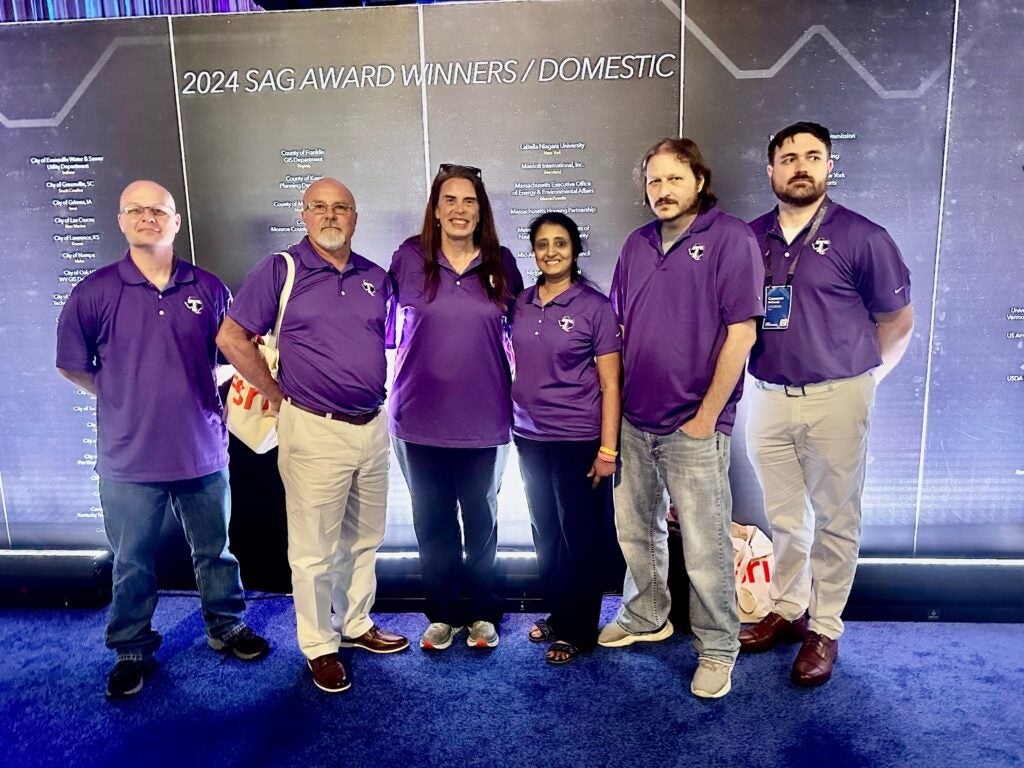
Esri’s annual SAG award is presented to organizations around the world to recognize outstanding work with GIS technology. The SAG award is an honor of great significance as RMA/CAE were among only 215 winning organizations nominated by Esri representatives from over 650,000 clients worldwide, which include Fortune 100 companies, national, state, and city governments, as well as 12,000 universities. The SAG awards were presented during the 2024 Esri User Conference in San Diego, Calif. on July 15-19, 2024. Several Tarleton State/CAE colleagues joined the USDA/RMA Business Analytics Division representatives to accept the award presented by president and co-founder of Esri, Jack Dangermond.
The Agricultural Risk Protection Act of 2000 (ARPA) required the USDA Risk Management Agency (RMA) to improve compliance and integrity within the Federal Crop Insurance Program (FCIP). As a result, RMA partnered with Tarleton State University’s Center for Agribusiness Excellence (CAE), established in 2000 to provide research, training, data warehousing, data mining, and advanced analytics to aid the government’s efforts to create efficiencies and maintain program integrity. CAE’s insights through these endeavors are delivered to the agency through the production of customized decision support systems and agricultural risk management products.
Over the 20+ year partnership, CAE and RMA have worked closely to establish a fully geo-enabled platform across both the multi-parallel processing and the ArcGIS Enterprise environments. The integration of geospatial data and the advancement of geographic information system technologies within the FCIP has provided decision makers the ability to derive data driven insights into what is happening in the field.
By utilizing location, an important variable in agriculture research, analysts can identify spatial patterns, analyze geographic distributions, and model relationships between programmatic data and other geo-enabled agricultural variables such as rainfall, temperature, soil types, etc. In addition, the ability to visualize complex datasets on a professional map helps convey geoanalytic findings and helps convey geoanalytic findings to decision makers in an accessible and meaningful manner.
Through a cooperative effort between RMA and CAE, geospatial services such as geospatial data warehousing, web mapping, cartography, and advanced geospatial analytics are now available across the agency. CAE’s custom developed web-based Hyper Dynamic Reporting Application (HyDRA) provides agency users the ability to access CAE’s analytic data products and professional services with ease. The geo-enriched tabular datamart reports, web mapping application, link analysis functionalities, and data portal — each located within the HyDRA Application — are indispensable tools utilized by RMA management, insurance services, compliance investigators, Approved Insurance Providers (AIP) and Farm Service Agency (FSA) investigators across the United States.
Some observations and comments from the geospatial team members who attended the conference were how the big picture of products CAE builds and supports were acknowledged and appreciated outside Tarleton State and RMA. One person perceived while the collective geospatial community might not fully understand what CAE does, the award serves as a testament that the industry recognizes the team’s outstanding work. Another was glad to learn how Esri is being used in many other fields including engineering and environmental science. Jennifer Ireland, manager of the Geospatial Team, noted: “Given the exceptional work being completed around the world, I felt honored to be recognized for CAE’s hard work and achievements in the field of GIS by one of the industry’s leaders.” All the attendees were impressed by the caliber of awardees and felt very honored to be part of a talented and global industry.
Troy Thorne, Director of CAE, also attended the conference.
“It was very satisfying to see the amazing team members here at Tarleton State University’s Center for Agribusiness Excellence get recognized publicly for their outstanding work,” he said. “ I see it every day and could not be more proud to be part of such an amazing organization here at TSU.”